You are viewing Version 3, the most recent version of this dataset.
3 version(s) available
Date of publication: December 8, 2022
Version 3
Date of publication: December 8, 2022
Type of change: Metadata
Description: update co-creator
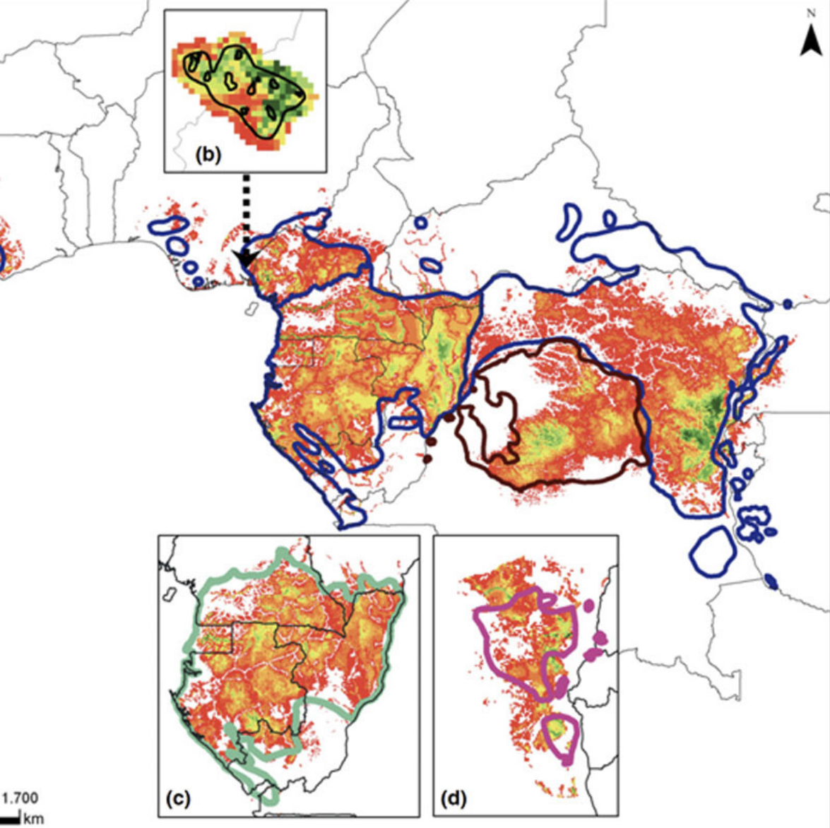
Habitat availability for African great apes
by Jessica JunkerThis first continent-wide analysis models suitable environmental conditions (SEC) for African great ape survival over a 20-year period, assesses the relative importance of factors influencing SEC distribution, and quantifies rates of SEC loss over time. SEC is defined as a measure of environmental and human impact variables, including human population density, poverty, distance to roads, precipitation, temperature, distance to rivers, forest cove ...(continue reading)
DOI 10.25829/f2rdp4Citation
Junker, J., Kühl, H. (2022). Habitat availability for African great apes (Version 3) [Dataset]. German Centre for Integrative Biodiversity Research. https://doi.org/10.25829/f2rdp4ApesAfrica
| Entities |
|---|
| Gorilla gorilla beringei |
| Gorilla gorilla diehli |
| Gorilla gorilla gorilla |
| Pan troglodytes elliotii |
| Pan paniscus |
| Pan troglodytes schweinfurthii |
| Pan troglodytes troglodytes |
| Pan troglodytes verus |
The EBV Data Portal is supported by


