You are viewing the Initial Version, the most recent version of this dataset.
1 version(s) available
Date of publication: December 15, 2022
Version 1
Date of publication: December 15, 2022
Type of change:
Description:
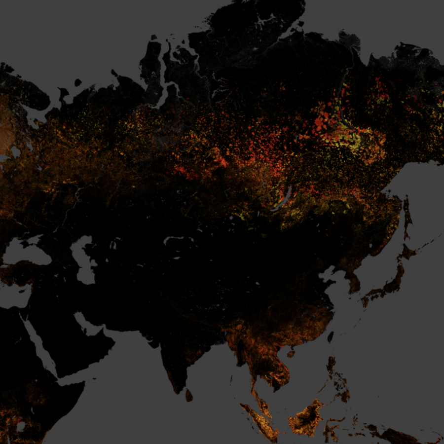
Forest loss from 2000 to 2020
by Miguel FernandezThis EBV dataset is based entirely on the time series analysis developed by Prof. Matthew Hansen and colleagues (2013) in version 1.8, which examines the global Landsat archive at a special resolution of 30 meters to characterize global forest extent and change from 2000 through 2020. In this EBV dataset we focus on "Forest Cover loss" defined as a stand-replacement disturbance, or a change from a forest to non-forest state. The original data fro ...(continue reading)
DOI 10.25829/a4pw92Citation
Forest loss
| Entities |
|---|
| Forest |
The EBV Data Portal is supported by


