You are viewing the Initial Version, the most recent version of this dataset.
1 version(s) available
Date of publication: February 25, 2022

Version 1

Date of publication: February 25, 2022

Type of change:

Description:
preview image

Local bird diversity (cSAR/BES-SIM)

by Ines Martins

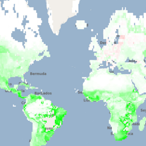
Changes in bird diversity at 1-degree resolution caused by land use, estimated by the cSAR model for 1900-2015 using LUH2.0 historical reconstruction of land-use. ...(continue reading)

Data: netCDF (3.84MB)
Metadata: ACDD (JSON) | EML (XML)

BirdsLUH 2.0 projectionsPREDICTSland-use

1
The title of the dataset. Local bird diversity (cSAR/BES-SIM)
The date on which this version of the data was created in YYYY-MM-DD format.
A paragraph describing the dataset.
Hover to see a suggestion for a good description. Allowed:
Changes in bird diversity at 1-degree resolution caused by land use, estimated by the cSAR model for 1900-2015 using LUH2.0 historical reconstruction of land-use.
Provide the DOI number of associated publications. Click Plus to add DOIs.
https://doi.org/
10.1101/2020.04.14.031716
The method of production of the original data.
Hover to see a suggestion for a minimum description.
Uses the LUH 2.0 projections for land-use, and PREDICTS based coefficients for bird affinities to land-uses. See more details in associated publication: Pereira et al. 2020, https://doi.org/10.1101/2020.04.14.031716
The coverage content type describes the general content type of the resource (multiple selection possible).
The name of the Project.
The name of the person or other creator type principally responsible for creating this data.
The email of the person or other creator type principally responsible for creating this data. istmartins@gmail.com
istmartins@gmail.com
The names of the co-creators responsible for creating this data. Click Plus to add co-creators.
Select between Creative Commons (CC) or Non-CC license.
Please select the CC license from the list. We recommend the use of CC BY 4.0

Essential Biodiversity Variables

Select the EBV class and the EBV name for the dataset. For cross-cutting use the comment at the bottom of the page for further information.
Genetic composition
Intraspecific genetic diversity
Genetic differentiation
Effective population size
Inbreeding
Other
Species populations
Species distributions
Species abundances
Other
Species traits
Morphology
Physiology
Phenology
Movement
Other
Community composition
Community abundance
Taxonomic and phylogenetic diversity
Trait diversity
Interaction diversity
Other
Ecosystem functioning
Primary productivity
Ecosystem phenology
Ecosystem disturbances
Other
Ecosystem structure
Live cover fraction
Ecosystem distribution
Ecosystem Vertical Profile
Other
Ecosystem services
Pollination
Other
Cross-cutting

Biological entity

Select the entity type of the dataset.
Species
Communities
Ecosystems
Other
None
A description of the range of taxa or ecosystem types addressed in the dataset. E.g. "300 species of mammals”, “Forests”, etc.
The reference as a URL. N/A

Metric

Provide the name, description, units of minimum 1 metric. Click Plus to add metrics.

Scenario

Spatial domain

Global
Continental/Regional
National
Sub-national/Local
degree
southWest lat: -90, lon: -180
northEast lat: 90, lon: 180

Temporal domain

The targeted time period between each value in the dataset.
decadal
annually
monthly
weekly
daily
Other
Irregular
Single time
Select the temporal extent of the dataset.
When the dataset represents a Single time, then use the same start and end date.
__

Environmental domain *

Terrestrial
Marine
Freshwater
Miscellaneous information about the data, not captured elsewhere. N/A